
Walk a Reston Street by Address
Street-by-street work in Reston begins with an address, not a presumed household list. Reston is a Fairfax County census-designated place, so the relevant tax, map, land, and election routes are county or state systems rather than a municipal Reston clerk. Start by matching the number, street, and unit. The property record may identify an owner or a mailing address, while a deed identifies people connected to a transaction. Neither field alone proves that a person currently occupies the site.
- Normalize the full address in the official postal lookup, then search the address in Fairfax County iCare. Record the situs, map number, legal description, and the date checked.
- Use the parcel and address layers in Fairfax GIS/Jade to confirm the road, parcel, unit context, and nearby features.
- Follow the parcel's book, page, or recorded-instrument reference through Fairfax Circuit Court land records when ownership history matters.
- For a lawful current-address check, ask the Fairfax County General Registrar about inspection of the public precinct list or a qualified voter-file request. Do not attempt to turn the protected voter-status form into a street list.
- Use regional reverse directories, newspapers, and library holdings only as dated historical evidence. Compare their address with the parcel and map record before assigning it to the same property.
That sequence keeps each source in its proper role. iCare ties an address to a property record. GIS places that property on the ground. Land records trace an instrument, and a public election record has statutory limits. The result is an evidence trail, not a claim that every person connected with an address lives there now.
Search the Reston Street Directory in iCare
Fairfax County Department of Tax Administration iCare is the practical starting point for a Reston street directory search. Its address mode accepts a house number, unit number, street text, and an optional suffix. The county's instructions say to leave the suffix off for the broadest results. An asterisk works as a wildcard, so a street fragment can surface the related parcel cards before each result is reviewed one by one.
| iCare field | Format | How it helps on a street |
|---|---|---|
| Number | Optional text | Enter the house number, or leave it blank for a wider street result. |
| Unit# | Optional text | Separates a condominium or apartment unit from the main street address. |
| Street | Optional text | Use a name or wildcard such as *woodland to find matching streets. |
| Suffix | Optional dropdown | Leave it off first, then narrow the result after reviewing similar road names. |
| Sort and results/page | Optional selects | Set the order and page size before opening individual parcel records. |
The official iCare address-search screen shows the optional number, unit, street, suffix, sorting, and result controls used for a Reston street directory search.
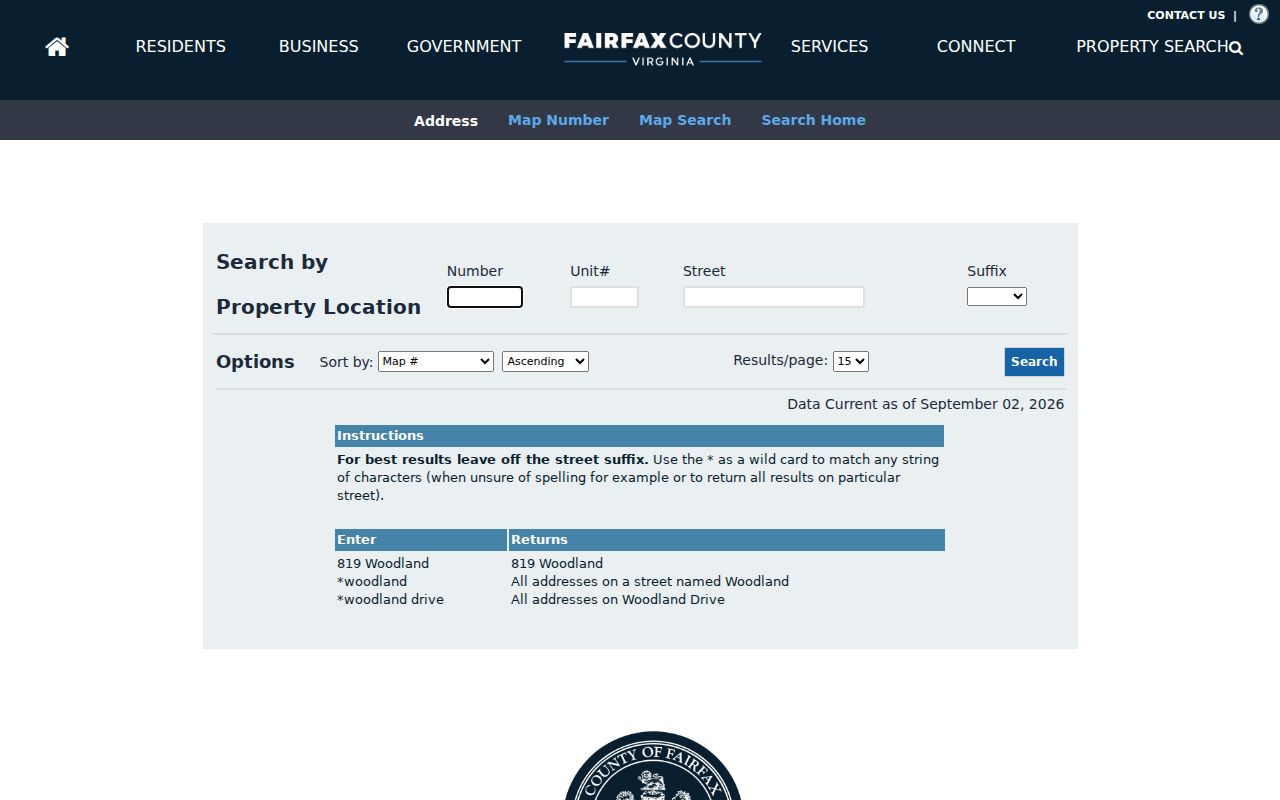
A broad result is only a starting set. Open each card to check the situs and unit rather than assuming that similar street text refers to the same Reston property.
The iCare map-number search provides a second route once an address result supplies the parcel identifier.
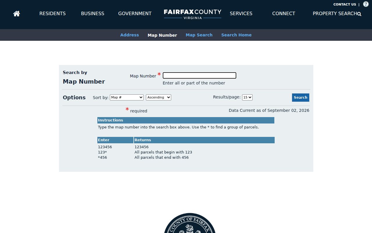
Map numbers are not street names, so translate the parcel back through its situs and legal-description fields before connecting it to a Reston street result.
iCare is free online and the assessment data are updated twice weekly. For a question that the card does not resolve, the Department of Tax Administration accepts assessment questions by phone, email, and mail; its published phone number is 703-222-8234. An online owner-name withholding request can produce a visible withheld-name state. The county says that state does not remove the name from office access, so a withheld web display should be reported as withheld rather than filled in from guesswork.
Separate Reston Situs and Mailing Fields
A situs address is the physical property location. A mailing address is where the county sends correspondence. They can be the same, but they are different fields and answer different questions. On a Reston parcel card, the map number, property location, tax district, subdivision or lot, zoning description, utilities, sales, values, and legal-description tabs can help confirm the parcel even when a mailing address points elsewhere.
Use the parcel's legal description as a cross-check when a street has similar units, a cluster name, or a changed address. The card can also show book and page information that points toward a land record. Assessment values are stated as of January 1, and GIS draws the parcel boundary for reference. Exact boundary lines come from the deed and, where necessary, a licensed surveyor, not from a screen image.
Map Reston Street Records in Jade
Fairfax GIS/Jade adds the spatial context that an address list lacks. It provides address points, parcel geometry, street names, political and hydrographic layers, property reports, historical aerial imagery, and neighborhood tools. The county describes its Master Address Repository as the verifier for site addresses, street names, and parcel IDs. DTA manages property data, while GIS displays and draws boundaries, so the two systems should be read together rather than treated as interchangeable.
Search the address or place, select the parcel, and turn on only the layers needed for the question. A map can explain why two units share a road name or why a trail, lake, or open-space parcel breaks an apparent block. Jade has more than 170 layers, which makes it useful for orientation but not a substitute for a recorded plat. Save or print the map with its date and selected layer if it will be compared later.
Note: A parcel polygon helps organize a Reston street search, but it does not establish a legal line or identify every person associated with the address.
Check Reston Street Records in PLUS
The county's PLUS portal adds address-linked planning, zoning, building, site, fire, environmental-health, and enforcement records. It can search by site address, parcel number, contractor-license information, record number, record type, or all records. Public results can show an address GIS ID, subdivision or parcel information, project status, conditions, locations, and, where public, attachments, inspections, or fees.
Use a PLUS result to understand the record attached to a property, not to infer a resident from a project. Some records have several locations, and some are withdrawn or closed. The system replaced FIDO, PAWS, and ProjectDox in 2022, while selected legacy material may be routed through Land Development Information History. A free account is for filing, tracking, and payment; browsing and searching do not require one.
A site-address result can also expose an address-changed date. Treat that as a lead for a street-history question, then compare it with the parcel, map year, and recorded description. It is not proof that a named individual moved on that date.
Compare Reston Streets on Older Maps
Reston's planned development makes older map layers especially helpful. Fairfax's Digital Map Viewer offers annual property-map years back to 1960, and the GIS archive includes aerial imagery back to 1937. A modern street name may be the endpoint of an earlier tract, cluster, or lot description. Select a property-map type, year, and tile, then compare its labels and lines with the current parcel rather than assuming the present street pattern existed at the earlier date.
The iCare advanced parcel-map screen documents the distance, units, buffer, layer, map-size, print, and export controls available when a Reston street directory search needs a mapped selection.
When using a buffer, record the distance, units, and whether the selection used center points or polygons. That makes a nearby-property result reproducible and avoids calling a radius an exact set of adjoining parcels.
Reston Street Directory Record Routes
No one Fairfax County record is a full street roster. Each route is keyed to a different event or property attribute. Use the address and map number to connect the sources, then preserve the date and the record type that produced each name. The table separates what can be learned from a public display from what must be confirmed through a research room, mail request, or qualified inspection.
| Address-keyed source | What it can show | Reston access route |
|---|---|---|
| iCare assessment card | Situs, map number, owner display where public, sales, tax, land-use, and parcel details. | Free online, or DTA phone, email, mail, and office contact. |
| GIS/Jade and Digital Map Viewer | Address points, parcel geometry, layers, aerials, and annual map context. | Free public map, search, selection, print, and export tools. |
| PLUS record | Address GIS ID, parcel, project description, conditions, record status, and locations. | Free public browse and search; legacy route when applicable. |
| Recorded deed or plat | Parties, legal description, lot, road, covenants, and recording details. | Land Records Research Room, Historic Records Center, CPAN, office, or mail copies. |
| Public precinct list | Limited statutory name, address, year, gender, and district fields. | Registrar inspection or a qualifying Virginia Elections request. |
- Parcel
- A defined piece of land represented by a map number and legal description.
- Situs address
- The physical location of the property, distinct from a tax mailing address.
- Plat
- A recorded map that can show lots, blocks, roads, easements, or subdivision geometry.
- Criss-cross directory
- An address-first directory used to look for a name or phone listing associated with a past address.
For historic work, the Fairfax Circuit Court Land Records Research Room offers free public inspection terminals from 8:00 a.m. to 4:30 p.m. on weekdays. Pre-1945 deed books are maintained by the Historic Records Center. The Land Records Office and CPAN cover later routes, and mail copy requests go to Suite 317 at 4110 Chain Bridge Road with the form, payment, and a self-addressed stamped envelope. Staff can help locate an instrument but do not perform a title search or give legal advice.
Trace Reston Street Deeds by Parcel
A deed chain starts with the parcel rather than a street-name match. From iCare, keep the map number, subdivision, lot or section, legal description, and book, page, or instrument reference. Read the current instrument for grantor, grantee, recording date, and prior-deed reference. Then search backward by both sides of each transfer while checking that the same lot or tract is still being described.
Fairfax land records reach to 1742, but the access route changes by era. The Historic Records Center's online deed-book indexes cover 1742 through 1866 in surname PDFs. Later physical indexes for 1866 through 1942 are at HRC, while the Land Records Office and paid CPAN route cover later material and published image ranges. A grantor, grantee, trustee, executor, heir, lender, or spouse named in an instrument has a transaction role. That role does not by itself establish residence at the situs.
Fairfax is a Library of Virginia Lost Records Locality. Civil War losses and missing or incomplete books can interrupt a chain, including gaps in deed books from the eighteenth and early nineteenth centuries. Mark the break, then compare probate, tax, map, newspaper, or directory evidence rather than interpreting a blank index as proof that nothing happened.
Inspect Reston Street Voter Data Lawfully
Virginia Code §24.2-444 governs the public precinct list. It includes voter name, residence address subject to protected-address rules, year of birth, gender, and election-district information, and is available for inspection at the registrar during business hours. The list is updated at least annually, with more frequent maintenance during the period before a general election. It is not a public current-household census.
The protected Virginia Citizen Portal requires the voter's name, date of birth, last four digits of a Social Security number, locality, and an authorization certification. It must not be used to assemble a street list. More complete voter-file products require qualifying client types, an active confirmed organization email, and an appropriate use. Fairfax County Elections can route public-list inspection questions by phone at 703-222-0776 or in person at the General Registrar's office.
Note: Protected voter addresses, Social Security information, day and month of birth, and other restricted fields stay outside a lawful street-record search.
Read Reston Clusters and Units Carefully
Reston is a planned community of village centers, clusters, lakes, trails, natural areas, and later transit-station areas. That history changes how a street directory should be read. A modern address may have grown from a tract, cluster, condominium, or planned-center reference, and a private road or unit number may be essential to a correct match. The historic survey places the first recognized residential occupants in Waterview Cluster in December 1964, before Reston's 1966 dedication.
Regional directories add a dated household layer, but their coverage is irregular. The Library of Congress has a 1960/61 Washington Metropolitan Area white-pages sample, and the regional criss-cross guide covers 1968 through 1996 with missing years. Reston Regional Library, the Virginia Room, and the Reston Times index can help identify relevant terms and issues. The historical volumes are treated in more depth in the Reston directory book.
Limits of a Reston Street Directory
A street search can document a property, a map position, a public owner display, a recorded party, or a lawful public-list entry. It cannot promise a complete list of everyone who lives on a road. Some owner names are withheld from iCare's online display. Voter records have protected-address rules. Court, vital, and private utility records have their own limits, and a deed may name a person involved in a transaction without identifying an occupant.
When the available sources disagree, keep the source label and date with each result. A postal label, CDP name, parcel situs, tax district, and election precinct may all describe the same area in different ways. A careful Reston street directory result states what a source actually shows, leaves deliberate gaps visible, and returns to the custodian when an official copy or clarification is needed.