
Reston Neighbors by Parcel
A Reston neighbors search works best as a block question, not as an indiscriminate name list. Begin with a target parcel, then identify adjoining parcels, nearby properties, roads, water, trails, and shared land. Fairfax County’s public systems describe different parts of that picture. Parcel and map tools establish geography. A property card can show a public owner or mailing display. A deed or plat can answer a legal-boundary question. A community directory can identify an association contact. None of those sources supplies a verified roster of everyone who lives around a Reston address.
| Source | What It Shows About a Block | Access |
|---|---|---|
| Fairfax iCare | Individual parcel cards, situs, public owner or mailing fields, map numbers, and property details | Free online, one parcel at a time |
| County parcel map and layers | Parcel boundaries, address points, roads, districts, water, trails, aerials, and map context | Free online layers and reports |
| iCare advanced map | Documented buffer selection around a parcel or address point | Free online map controls |
| Recorded deeds and plats | Legal adjacency, lots, easements, road dedications, and tract history | Research room or index route |
| Association contact directory | Cluster or condominium association contacts and community context | Public contacts, not a resident list |
| Library and local history | Old maps, photographs, neighborhood terms, notices, and historic context | Reference and archival access |
Owners and occupants are different roles. A public owner display may identify a person, trust, estate, or organization connected with a Reston parcel, while the mailing address can be elsewhere. A parcel with no public name still matters to the map, and a parcel with a name does not prove present occupancy. Record what the source actually labels.
Set a Reston Neighbor Boundary
“Next door,” “on my block,” and “nearby” are not the same Reston request. Directly adjoining parcels share a boundary. Nearby parcels come from a chosen radius or buffer. Roads, lakes, trails, and common open space can separate two Reston parcels that look close on a screen. Start by choosing the intended relationship, then write it down before opening any parcel cards. This keeps a narrow parcel inquiry from drifting into an undefined set of nearby Reston parcels.
Fairfax iCare’s advanced map presents controls for distance, units, center points or parcel polygons, selection by buffer, layers, output size, and export. A reproducible Reston buffer note includes the target address or map number, distance, unit, center-point or polygon setting, map date, and selection method. The viewer is a reference tool. It does not decide the legal line between Reston parcels, which is a question for a recorded instrument or survey.
Note: Write down the map settings before comparing Reston parcels, because a changed buffer can produce a different neighbor set.
Map Reston Neighbors Parcel by Parcel
The Fairfax GIS maps page leads to Jade, property reports, address search, historical aerials, and neighborhood tools. Find the target Reston address, select its parcel polygon, and inspect the polygons that directly touch it. A map can also reveal a frontage road, water edge, trail, public facility, or common area that changes what a nearby result means. Use the GIS layer as geographic context, then open each Reston parcel separately rather than assuming one card describes the whole block.
The Fairfax GIS and Jade landing page shows the county’s property-report, layer, aerial-imagery, address-search, and neighborhood tools.
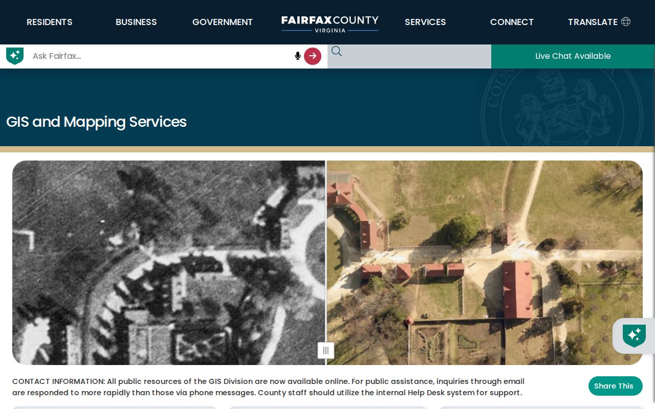
Save or print the Reston map context with its selected layers, then use its parcel identifiers to check each property card individually.
- Search the exact Reston address in iCare and save the situs, map number, legal description, and date checked.
- Select the target polygon in Jade or the iCare map, then identify the directly touching polygons and any road, water, trail, or green-space break.
- If “nearby” is intended, run a buffer and preserve the distance, units, map date, and center-point or polygon choice.
- Open each selected Reston parcel card for its own address, land use, lot or subdivision, sales, and public owner-display fields.
- Use deeds or plats when the Reston boundary, easement, original tract, or road dedication matters more than the map display.
For a whole named road rather than the immediate Reston block, the Reston street directory follows the broader address-record chain.
Read Every Reston Neighbor Parcel
A parcel card should be read as a property record. The Reston iCare card can display a map number, property location or situs, book and page, tax district, land-use code, acreage or square feet, zoning description, utilities, historic-overlay information, legal description, sales, values, and structure details. Public owner and mailing fields can appear when available. The card also separates a property’s map identity from its postal wording, which is useful when a Reston address has changed form over time.
The sample Fairfax iCare parcel card displays the map, owner and mailing fields when public, situs, land-use, zoning, legal-description, sales, value, and neighborhood actions described by the county.
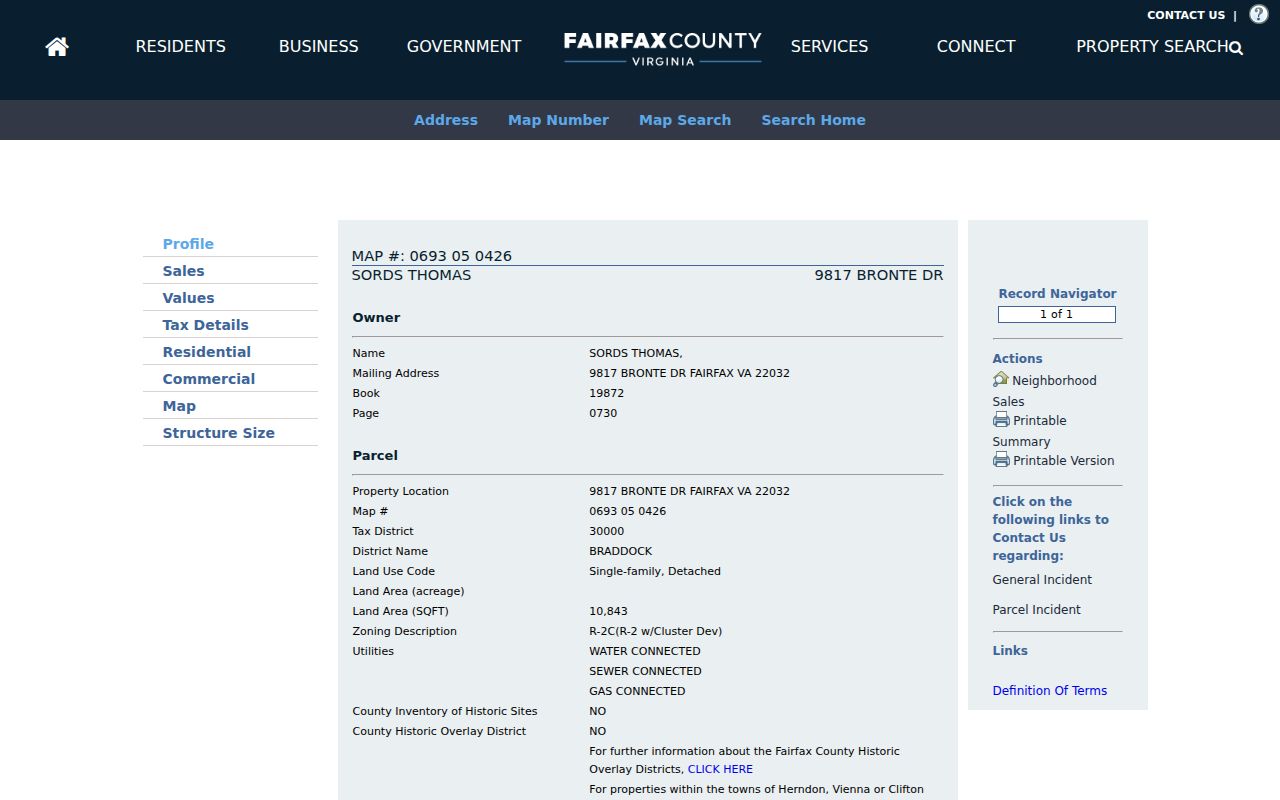
Compare the map number and situs shown on each card with the selected Reston polygon, and preserve “Name withheld by request” if that is the official online display.
A withheld owner name is not an invitation to guess. Fairfax County says online withholding leaves the parcel record in place and distinguishes the web display from office access. A parcel card also does not determine who currently occupies a property. Treat the displayed field as an owner or mailing role unless a separate source gives a different, dated role.
Reston Neighbor Association Contacts
Reston has a private community-association layer alongside its Fairfax County parcel records. Reston Association says that the community has more than 160 sub-associations and provides public resource routes for clusters, condominiums, covenants, design review, districts, and community questions. Those resources can help connect a Reston street or cluster to the right point of contact. They do not identify every person associated with an address.
| Reston contact route | What it can help identify | Boundary to keep |
|---|---|---|
| Reston Association Member Resources | Sub-association resources, districts, covenants, design review, and community routing | Use the resource to find the relevant association context, not a resident roster |
| Cluster and Condo Association Directory | Public cluster or condominium contact points and stated contact route | The directory was updated March 2, 2026 and is a contact directory, not a list of owners or occupants |
| Reston Association Covenants staff | Questions about the public directory route or association context | Use the published COV@reston.org contact and follow the association’s access rules |
Reston planning labels such as Lake Anne, Waterview, Hunters Woods, Glade, North Shore, and South Shore should be verified against a plan, map, association directory, or parcel record. A familiar neighborhood name may not be the legal subdivision printed on the Reston card or deed. Association contacts are useful for community matters, but they are not evidence of a person’s residence.
Reston Neighbors Beyond Lot Lines
Reston’s planned geography gives a neighbor map more context than a row of adjoining lots. The comprehensive-plan material describes five village centers, four lakes, connected natural areas, and about 55 miles of trails. A nearby Reston polygon can therefore be open space, water, a trail corridor, or a common area rather than another household parcel. That is why a map-based Reston block search should name the physical break between parcels instead of calling every close feature “next door.”
For older Reston questions, the Digital Map Viewer provides annual property-map years back to 1960, while county GIS materials include historical aerial imagery. Compare the correct map year with the parcel’s legal description and any deed or plat. The map can explain a changed boundary, road label, or development pattern. It cannot by itself name past residents. Reston Regional Library, Fairfax local-history collections, and a Reston museum collection provide context when a map needs historical interpretation.
Note: A Reston map layer is valuable context, but a recorded plat or survey controls when the exact legal boundary is important.
Reston Neighbor Voter Limits
Virginia voter information has a defined legal route, not a general Reston neighbor-search function. The Virginia Citizen Portal requires the voter’s first and last name, date of birth, last four digits of the Social Security number, locality, and an authorization certification. It should not be used to assemble a block list. The portal may provide authorized status and polling information, but it is not a public census of Reston residents.
Va. Code §24.2-444 provides for public precinct-list inspection at the registrar with limited fields, including name, residence address subject to protected-address rules, year of birth, gender, and election-district information. Protected addresses and sensitive identity fields remain excluded. More complete voter-file products require qualified client types and a defined request. A valid Reston parcel map should not be used to bypass these protections, and a voter record should never stand alone as proof of occupancy.
Compare Reston Neighbor Sources
Different Reston sources answer different questions. Official parcel, court, voter, and association records preserve the purpose and limit of the underlying record. Commercial neighbor-lookup tools may combine old addresses, public snippets, and other data into an easy-looking list, but a combined result can hide dates, roles, corrections, and withholding decisions. Use a custodian record when the question concerns a specific field, and preserve the source date when comparing nearby Reston parcels.
| Source type | Strength for a Reston block | Important limit |
|---|---|---|
| Official parcel and map records | Direct address, parcel, map, and public property context | Owner or mailing fields do not prove occupancy |
| Recorded deed or plat | Legal description, title roles, and boundary history | Needs interpretation and may not list current occupants |
| Association contact directory | Community routing and cluster context | Not a member or resident list |
| Commercial neighbor tools | May offer broad leads to test | Dates, roles, accuracy, and correction paths can be unclear |
When an official Reston source is unclear, keep the open question instead of filling it with an unverified match. The Fairfax Circuit Court Land Records research room and Historic Records Center can supply land-record context, while the Reston library and archive collections can help interpret older neighborhood names. A dated, narrow result is more reliable than a long but unsupported neighbor list.
Protect Reston Neighbor Privacy
Reston neighbor research has firm privacy boundaries. iCare can show an owner name as withheld by request. Protected voter addresses are excluded from public precinct lists. Confidential, sealed, and juvenile court information may not appear online. Virginia’s Address Confidentiality Program, under Va. Code §2.2-515.2, provides a substitute designated address and mail-forwarding route for eligible participants. An absent result can be intentional and should remain a gap.
Do not publish or try to reconstruct protected addresses, birth dates, Social Security fragments, victim information, or private contact details. Cite the public source, record the date checked, and state the role it actually shows. For a correction or access question, contact the Fairfax or Virginia custodian that maintains the record. Reston association contacts should also be used only for the public community purpose they state.
Lawful use. Use Reston neighbor records for lawful personal research, community context, and civic questions. Never use a result to stalk, harass, intimidate, or harm another person.